


What to know
Visit Cossatot River State Park’s Official Website
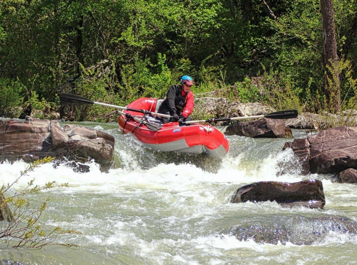
Just 45 minutes south of Mena is Arkansas’ newest State Park. The park includes 11 miles of one of the most rugged and spectacular river corridors in the central United States. With over 5,302 acres of rugged wooded slopes, trails, outstanding geological features, cascading clear water and Class III, IV, and even Class V rapids, the Cossatot is a favorite with skilled canoeists, rafters and kayakers. The challenging waters of the Cossatot is not recommended for beginners.
Our Location
Things to Do & See:
Cossatot Visitor Information / Education Center
Open: 8 a.m. – 5 p.m. daily
Closed: New Year’s Day, Thanksgiving Day, and noon Christmas Eve through Christmas Day
The 15,000-square-foot visitor information/education center is on U.S. 278 east of Wickes where the highway crosses the Cossatot. The facility showcases interactive exhibits of the area’s history, as well as animals, vegetation, to topography, etc. The center also features a large exhibit gallery, two classroom/lab rooms, a wildlife viewing area, gift shop, and park administrative offices. Explore the interpretive exhibits that share the story of “The Cossatot: A River for All Seasons” and focus is on the river’s ecology. Three information kiosks provide information about the Cossatot River, the park-natural area, and other parks and museums in Arkansas’s state park system.

Interpretive programs and workshops are offered in the park throughout the year. These tell of the geology, flora, and fauna here in this remote and protected river corridor. Special interpretive programs include guided kayak tours and snorkeling tours.
Cossatot River State Park-Natural Area’s 5,401 acres emphasize outdoor recreation, river preservation, and environmental education. The park is managed by Arkansas State Parks and the Arkansas Natural Heritage Commission.
Chasing the Rapids!
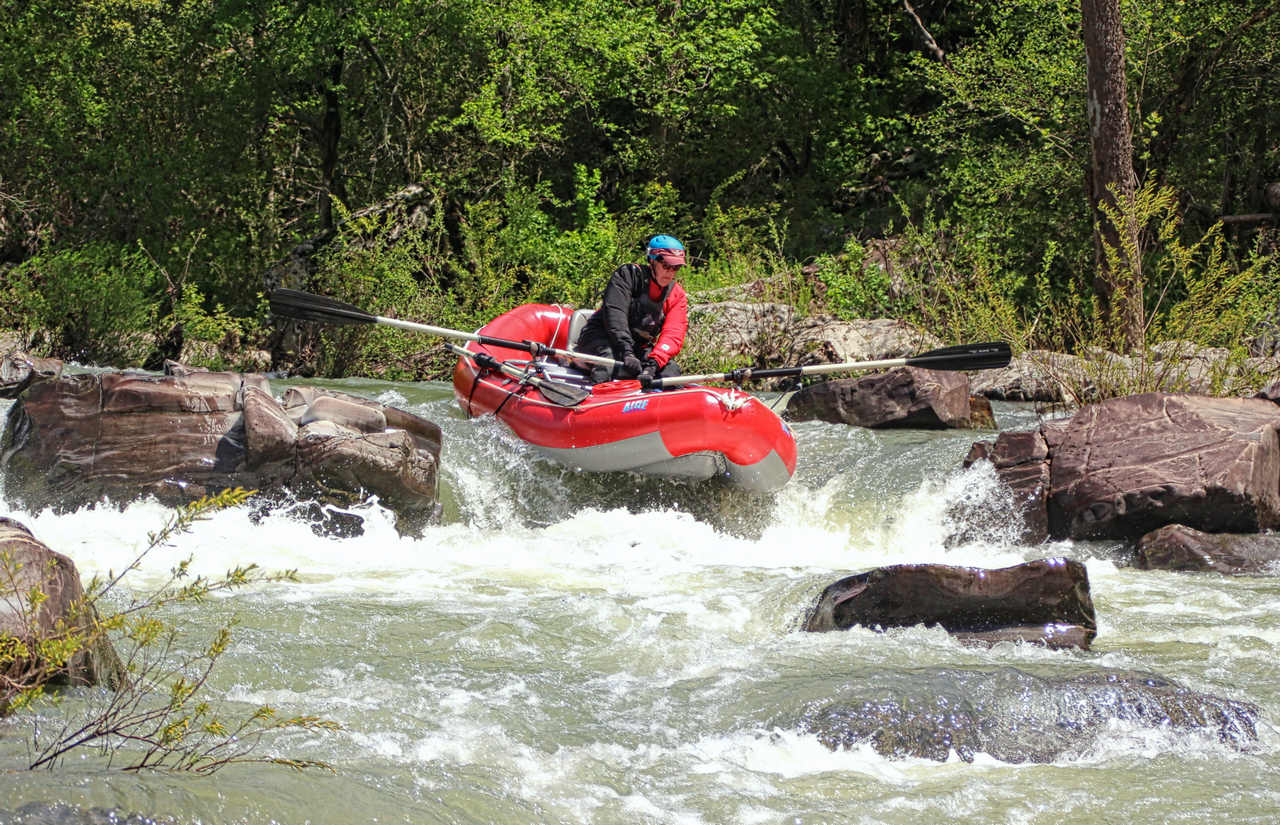
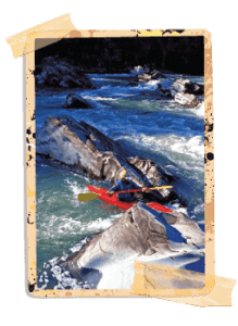 If the term “skull crusher” (the Indian name for Cossatot) isn’t a deterrent and excites you, then you’ll want to conquer the waters of the Cossatot River. Defined by the National Park Service as “the most challenging whitewater float in Arkansas,” Cossatot’s waters are not for the casual paddler. The river’s characteristics give it Class IV/Class V ratings.
This park-natural area stretches for 12 miles along the wild and scenic Cossatot River, Arkansas’s premier whitewater experience renowned as the best whitewater float stream in mid-America. Located in southwest Arkansas south of Mena, the Cossatot forms Cossatot Falls, a rugged and rocky canyon that challenges the most experienced canoeists and kayakers with its Class IV and V rapids. When the water is high, the paddlers are here. This National Wild and Scenic River is a watershed basin with flow levels dependent on rainfall. After significant precipitation, the river level rises, allowing experienced paddlers the opportunity to test their skills in challenging whitewater. In the river’s Cossatot Falls area with its distinct ledges, the river drops 33 feet in elevation within 1/3 of a mile. Floatable river levels are usually limited to late-fall, winter and spring. Late winter to early spring is peak whitewater paddling season here. Class III-V whitewater is for experts only. For river stage information (in feet) from the Ark. 246 access, call 870-387-3141, or visit the U.S. Geological Survey website for Cossatot River real time data at: waterdata.usgs.gov/nwis/uv?07340300.
Hiking & Interpretive Trails
Brushy Creek Nature Trail
Trail Difficulty: Easy Trail Type: Hiking
The Brushy Creek Nature Trail starts on the west side of the river and provides barrier-free access to a pedestrian walkway over the river. The trail continues to the picnic are
a on the east side of this recreation area.
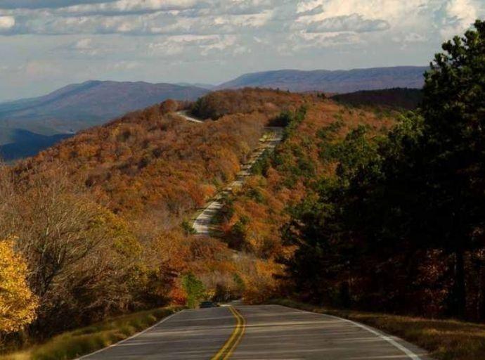
Cossatot River State Park-Natural Area is south of Mena. The
northern route to the park is via Ark. 246 between Vandervoort and Athens. The southern route is via U.S. 278 between Wickes and Umpire.
Waterleaf Interpretive Trail Trail Difficulty: Easy
Trail Type: Hiking, ADA Accessible
The Waterleaf Interpretive Trail has ¼ loop that is ADA accessible and is located just east of the VIC parking lot. The ADA section has wayside exhibits to assist visitors with their understanding of this area. The second section of the trail (not ADA accessible) leads off the North Slope for ¼ mile to the Highway 278 access. Excellent example of forest types found along north slopes in the Ouachita Mountains.
Harris Creek Trail
Trail Difficulty: Moderate
Trail Type: Hiking
Official Trail Map
The Harris Creek Trail is located off of Hwy. 278, approximately 9 miles east of Wickes, AR. This 3 mile trail features easy to moderately difficult walking that passes through six different habitats that range from a dry open shale pit to a mature short-leaf pine/hardwood forest. Half way through the trail there is an overlook that offers a spectacular view of the Cossatot River as it winds its way through the Ouachita Mountains.
River Corridor Trail
Trail Difficulty: Strenuous
Trail Type: Hiking, Backpacking
Official Trail Map
The River Corridor Trail head is located off of Hwy. 246, approximately 8 miles east of Vandervoort, AR. This trail is a linear trail that winds its way through some of the roughest, yet most scenic, terrain found in the Ouachita Mountains. The trail is broken up into sections according to the river access areas. Plan for approximately six-eight hours per leg. This trail is excellent for backpacking, but park management asks that hikers limit their camping to the access areas, (Ed Banks, Sandbar, Cossatot Falls and Hwy. 278 Access Area.) Parking is available at each of the access areas if you do not wish to hike the entire trail. Along the way you will observe many wonderful views of the river corridor and its geological features. The terminus for this trail is the Hwy. 278 Access Area.
Rare Plants of the Cossatot River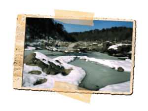
Rare Plants Identification Brochure
Many plants that occur in the Ouachitas occur nowhere else. These are called “Ouachita Mountain endemic species.” Other plants are said to have their “population center” located in the Ouachita Mountains. This means most of the plants occur in the Ouachita Mountains, with just a few known to occur outside the Ouachita Mountains. Other plants which occur here are rare because they are on the edge of their geographic range, they are rare throughout their range, or human activities have destroyed their habitats. Currently, there are 28 rare plants known to occur in the park.
Information on this page about this State Park taken from Cossatot River Official Website.
Visit ArkansasStateParks.com to find other Arkansas Attractions and State Parks information.
Other Local Attractions