The incredible scenery and terrain of the area offers great hiking opportunities for nature lovers. Beginners and expert hikers will find the perfect trail in our neck of the woods. Majestic waterfalls, protected wildlife areas, scenic overlooks and natural, untouched forests are just a few of the attractions in our outdoor adventures. Discover our local trails in the Ouachita National Forest and the local Arkansas State Parks.
Tips from the US Forest Service
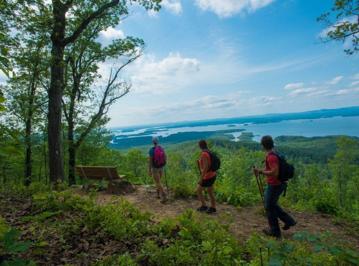
Ouachita National Recreation Trail
Ouachita National Recreation Trail
This is the longest trail in the Ouachita National Forest spanning 192 miles across its entire length. There is so much to see on this trail, we gave it its own page! Click the link above.
Earthquake Ridge
Trail Map: Earthquake Ridge Trail Map
Difficulty: Moderate
This trail parallels the Talimena Scenic Byway is on the north and south sides of Rich Mountain.
The day hiker will view several interesting rock formations as well as a variety of plant and animal life. The trail system crosses the Talimena Scenic Byway twice.
Many mountain bikers find this trail system an exciting challenge. There are several loops that enhance this challenge.
Surrounding Area:
• Queen Wilhelmina State Park
• Blue Haze Vista
• Acorn Vista
• Ward Lake
• Talimena Scenic Drive
Orchard Trail
Trail Map: Orchard Trail Map
Difficulty: Easy
This accessible trail meanders through the picturesque pine and hardwood forest surrounding the Talimena Scenic Byway Visitor Information Station near Mena, AR. This short hike features the ruins of an abandoned home site with a viewing deck and benches. This trail and all site facilities allow easy access for all visitors including those physically challenged.
Surrounding Area:
• For an extended hike try the 2.8 mile Earthquake Ridge Hiking and Mountain Bike Trail beginning at the northwest side of the Visitor Information Station parking lot.
• Continue driving west on the Talimena Scenic Byway and enjoy the beautiful vistas from high mountain ridgelines and cultural treasures such as Rich Mountain Fire Tower and Pioneer Cemetery.
• The Queen Wilhelmina State Park Lodge at the top of Rich Mountain offers travelers a beautiful and historic place to spend the night or enjoy a tasty meal.
Queen Wilhelmina State Park Trails
For more information about Queen Wilhelmina State Park visit the official website at: Queen Wilhelmina State Park
Trails Map: Queen Wilhelmina State Park Trails Map
Lovers Leap Trail
Difficulty: Easy to Strenuous
This trail begins at the stairs on the north-east side of the lodge circle drive. The first 1/3 of the trail is a nice stroll along the north slope of Rich Mountain. With bridges, stairs and benches to rest on, you can easily make the gentle climb to the wooden overlook and be rewarded with a panoramic view of the south slope of Rich Mountain and Powell Valley.
Beyond the overlook, the trail is a little more difficult due to elevation changes, rocky areas and steep slopes. Just past the overlook, the Ouachita National Recreation Trail turns left; this intersection is well marked. The Lover’s Leap Trail continues to the right at this junction. It descends along the south face of the mountain through the rich hardwood forest and back to the south side of the lodge. The climb up to the lodge may be strenuous.
Reservoir Trail
Difficulty: Moderate
This trail begins south of the lodge at the stairs, and continues 1/3 of a mile down the hill to a stone reservoir. The reservoir was part of the water system for the 1898 hotel. Just up the hill from the reservoir is an excellent spring that was said to have curative powers.
Spring Trail
Difficulty: Easy
Beginning behind the stage at the amphitheater, you’ll walk west 100 yards to the spring. This was a favorite gathering place for early mountain settlers and is still a great oasis of relaxation and reflection. The trail continues past the spring for about 1/2 mile and comes out on State Highway 88 across from the west end of the campground. You may return by the same trail, or cross the road into the park.
Shady Lake Trail
Trail Map: Shady Lake Trails Map
Difficulty: Easy
The 0.5 mile interpretive trail introduces basic facts about soil, rocks, and plants, describing the unique characteristics and various uses of 12 species of trees. Visitors who prefer a longer excursion will enjoy the 3.2-mile trail along the lakeshore.
Wolf Pen Gap Trail System
Trail Complex Map: Wolf Pen Gap Trail System
Difficulty: Easiest – Most Difficult
Featuring high mountain vistas, the trail leads the rider through an array of areas, including scenic Gap Creek and Board Camp Creek.
The trail continues through a forest of large pines and hardwoods before passing the unique 2-footed oak tree and an abandoned mine shaft.
The trail loops are connected to accommodate riders who want to vary the length of their trips.
Surrounding Area:
• Enjoy the beautiful scenery along the Cossatot Scenic and Recreational River.
• For an extended hike, there are 18 miles of hiking trails in the Caney Creek Wilderness.
• South of Caney Creek is the Shady Lake Recreation Area, which offers camping, fishing, swimming, boating and hiking at the campground.