What to know
Our Location
About the Forest
Ouachita National Forest was established in 1907 by President Roosevelt and was known as the Arkansas National Forest. The forest became known as the Ouachita National Forest on April 29, 1926.
Hernando DeSoto was the first the first to explore the vast mountain range in 1541. The local Indians called the range “Washita” which meant “good hunting grounds”. The name “Ouachita” is the French spelling of this word and was widely accepted as the official name of the mountain range.
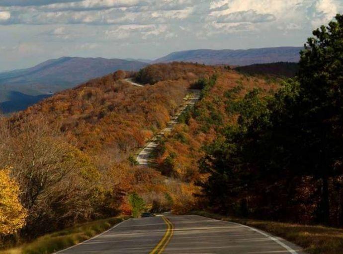
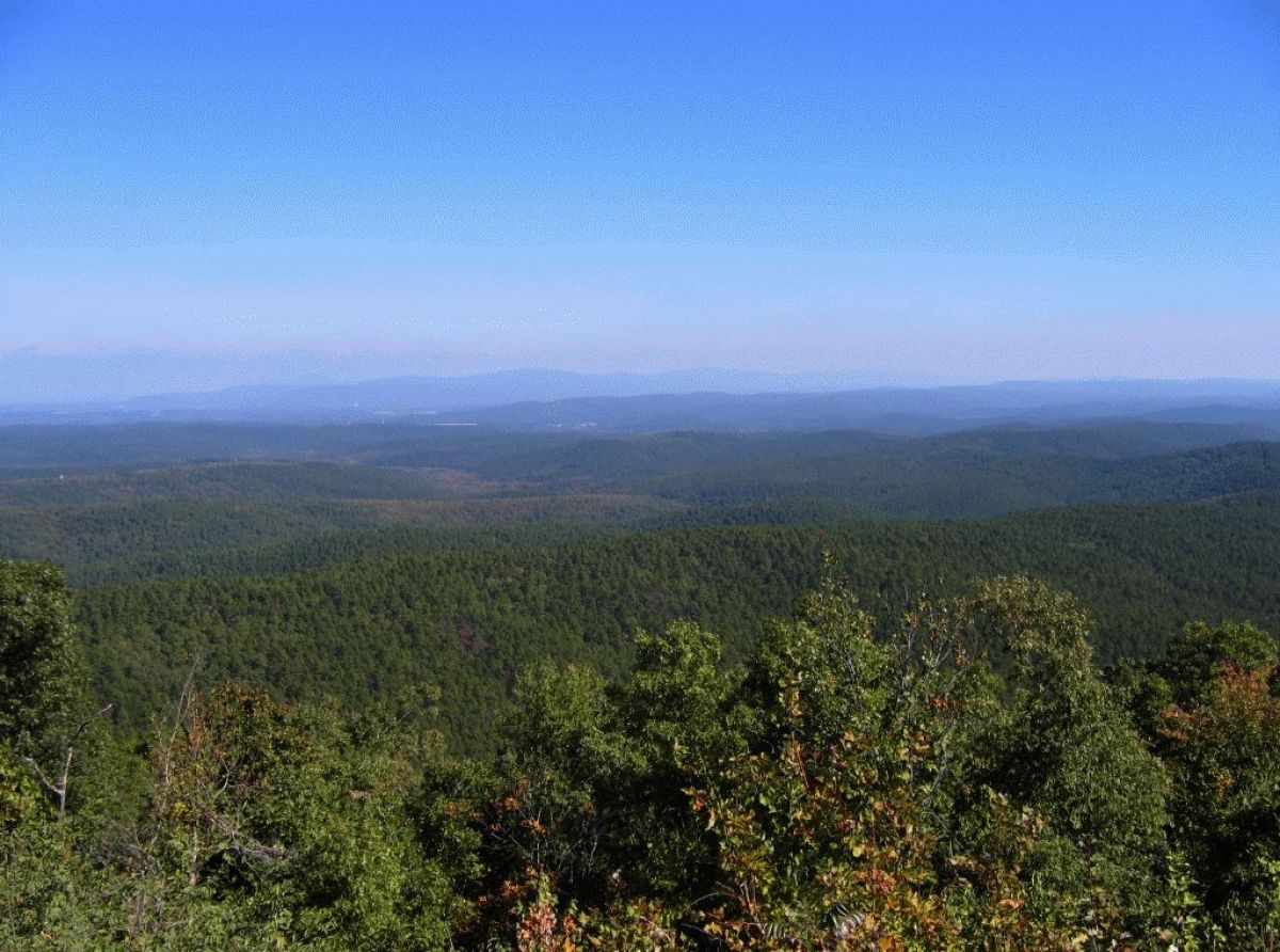
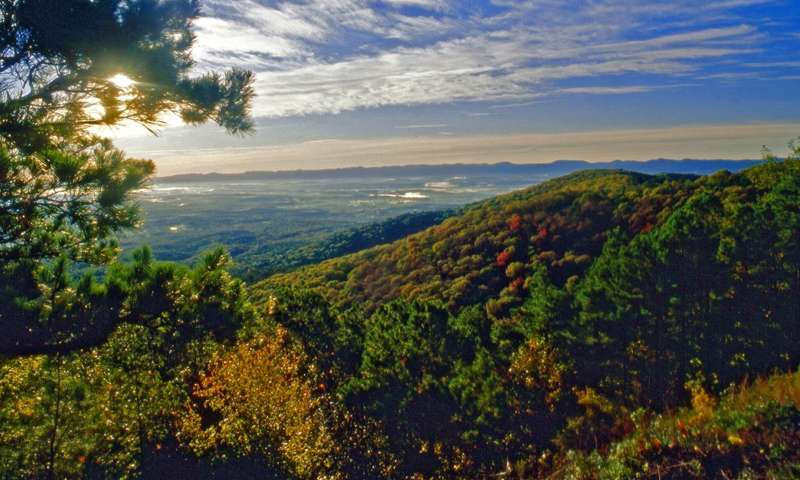
The Ouachita Mountain Range is the only mountain range that runs east and west. The forest was originally only 589,973 acres in size today it totals 1,789,666 acres with 1,434,872 in Arkansas and 354,794 in Oklahoma. This rugged mountain landscape makes premier sightseeing and trails the focus of the forest. Seasonal flora, streams and lakes, wildlife, and pristine scenery set the stage for recreation experiences.
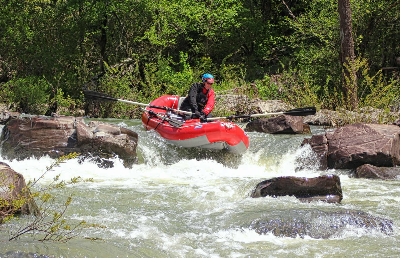
Enjoy outstanding mountain views, picturesque streams, rivers, and lakes, Experience high quality nature-related sightseeing, camping, off-highway vehicle riding, mountain biking, horseback riding, hunting, fishing, non-motorized boating, and dispersed camping. Learn about the areas rich history at wayside exhibits along the Talimena National Scenic Byway. Visit our recreation pages to learn more about all of the outdoor recreation opportunities the Ouachita has to offer!
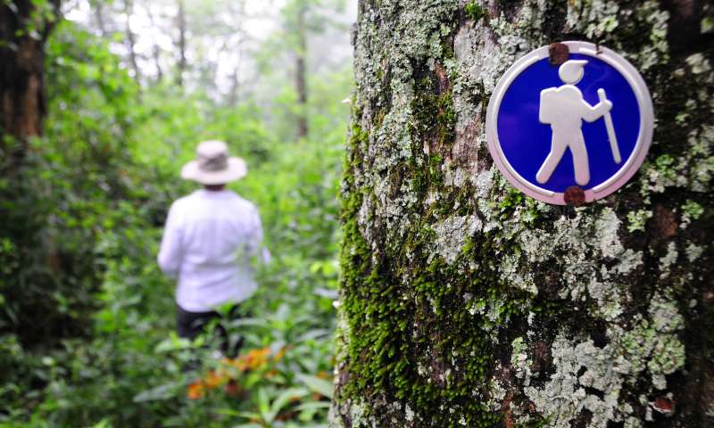
Hiking
The incredible scenery and terrain of the area offers great hiking opportunities for nature lovers. Beginners and expert hikers will find the perfect trail in our neck of the woods. Majestic waterfalls, protected wildlife areas, scenic overlooks and natural, untouched forests are just a few of the attractions in our outdoor adventures. Discover our local trails in the Ouachita National Forest and the local Arkansas State Parks.
Tips from the US Forest Service
Ouachita National Recreation Trail
Ouachita National Recreation Trail
This is the longest trail in the Ouachita National Forest spanning 192 miles across its entire length. There is so much to see on this trail, we gave it its own page! Click the link above.
Earthquake Ridge
Trail Map: Earthquake Ridge Trail Map
Difficulty: Moderate
This trail parallels the Talimena Scenic Byway is on the north and south sides of Rich Mountain.
The day hiker will view several interesting rock formations as well as a variety of plant and animal life. The trail system crosses the Talimena Scenic Byway twice.
Many mountain bikers find this trail system an exciting challenge. There are several loops that enhance this challenge.
Surrounding Area:
• Queen Wilhelmina State Park
• Blue Haze Vista
• Acorn Vista
• Ward Lake
• Talimena Scenic Drive
Orchard Trail
Trail Map: Orchard Trail Map
Difficulty: Easy
This accessible trail meanders through the picturesque pine and hardwood forest surrounding the Talimena Scenic Byway Visitor Information Station near Mena, AR. This short hike features the ruins of an abandoned home site with a viewing deck and benches. This trail and all site facilities allow easy access for all visitors including those physically challenged.
Surrounding Area:
• For an extended hike try the 2.8 mile Earthquake Ridge Hiking and Mountain Bike Trail beginning at the northwest side of the Visitor Information Station parking lot.
• Continue driving west on the Talimena Scenic Byway and enjoy the beautiful vistas from high mountain ridgelines and cultural treasures such as Rich Mountain Fire Tower and Pioneer Cemetery.
• The Queen Wilhelmina State Park Lodge at the top of Rich Mountain offers travelers a beautiful and historic place to spend the night or enjoy a tasty meal.
Queen Wilhelmina State Park Trails
For more information about Queen Wilhelmina State Park visit the official website at: Queen Wilhelmina State Park
Trails Map: Queen Wilhelmina State Park Trails Map
Lovers Leap Trail
Difficulty: Easy to Strenuous
This trail begins at the stairs on the north-east side of the lodge circle drive. The first 1/3 of the trail is a nice stroll along the north slope of Rich Mountain. With bridges, stairs and benches to rest on, you can easily make the gentle climb to the wooden overlook and be rewarded with a panoramic view of the south slope of Rich Mountain and Powell Valley.
Beyond the overlook, the trail is a little more difficult due to elevation changes, rocky areas and steep slopes. Just past the overlook, the Ouachita National Recreation Trail turns left; this intersection is well marked. The Lover’s Leap Trail continues to the right at this junction. It descends along the south face of the mountain through the rich hardwood forest and back to the south side of the lodge. The climb up to the lodge may be strenuous.
Reservoir Trail
Difficulty: Moderate
This trail begins south of the lodge at the stairs, and continues 1/3 of a mile down the hill to a stone reservoir. The reservoir was part of the water system for the 1898 hotel. Just up the hill from the reservoir is an excellent spring that was said to have curative powers.
Spring Trail
Difficulty: Easy
Beginning behind the stage at the amphitheater, you’ll walk west 100 yards to the spring. This was a favorite gathering place for early mountain settlers and is still a great oasis of relaxation and reflection. The trail continues past the spring for about 1/2 mile and comes out on State Highway 88 across from the west end of the campground. You may return by the same trail, or cross the road into the park.
Shady Lake Trail
Trail Map: Shady Lake Trails Map
Difficulty: Easy
The 0.5 mile interpretive trail introduces basic facts about soil, rocks, and plants, describing the unique characteristics and various uses of 12 species of trees. Visitors who prefer a longer excursion will enjoy the 3.2-mile trail along the lakeshore.
Wolf Pen Gap Trail System
Trail Complex Map: Wolf Pen Gap Trail System
Difficulty: Easiest – Most Difficult
Featuring high mountain vistas, the trail leads the rider through an array of areas, including scenic Gap Creek and Board Camp Creek.
The trail continues through a forest of large pines and hardwoods before passing the unique 2-footed oak tree and an abandoned mine shaft.
The trail loops are connected to accommodate riders who want to vary the length of their trips.
Surrounding Area:
• Enjoy the beautiful scenery along the Cossatot Scenic and Recreational River.
• For an extended hike, there are 18 miles of hiking trails in the Caney Creek Wilderness.
• South of Caney Creek is the Shady Lake Recreation Area, which offers camping, fishing, swimming, boating and hiking at the campground.
National Wilderness Areas
The Mena area hosts two of the six designated wilderness areas in Arkansas, and Caney Creek Wilderness Area is the largest designated wilderness in the state of Arkansas. Wilderness areas offer special opportunities to enjoy solitude or a primitive, unconfined type of recreation. No developed recreation facilities are found here and there are few, if any, signs to guide you. Mountain bikes, hang gliders, and motorized vehicles are not permitted.
Visitors willing to travel these rugged areas by foot or horseback will find a variety of settings in which to explore, discover,enjoy the solitude, scenic beauty, inspiration, primitive recreation, and natural ecosystems found here.You can help protect and preserve the unique wilderness characteristics for the enjoyment of this and future generations by practicing the
no-trace ethic, “tread lightly” and remember to “PACK IT IN AND PACK IT OUT.”
Black Fork Mountain Wilderness Area
Located 6 miles north of Mena on U.S. 270 is the Black Fork Mountain Wilderness Area. Created by an act of Congress in 1984, the wilderness covers an area of 13,139 acres and is managed by the U.S. Forestry Service.
This infrequently visited wilderness follows the main ridge-line of Black Fork Mountain for 13 miles (21 km) which rises to more than 2,400 feet (731 m). Steep cliff sides provide sanctuary to groves of Dwarf Oak, Serviceberry and Granddaddy Greybeard (known as the fringe tree Chionanthus) which have a few unique species represented here.
Visitors should expect difficult hiking conditions and few sources for water as there are only two springs along the higher mountain slopes. Black bears are known to inhabit the wilderness, along with White-tailed deer, bobcat, skunk and Pheasant.
The wilderness contains extensive areas of unlogged, old-growth forest. Along the ridge of Black Fork Mountain are several thousand acres of stunted old-growth Post Oak, Shortleaf Pine, and Hickory.
Caney Creek Wilderness Area
Caney Creek Wilderness Area is the largest designated wilderness area in the State of Arkansas. At 14,460 acres, this area features: rugged, nearly untouched forests, scenic overlooks, flowing streams and hiking trails.
Many Recreation areas can be found in the Caney Creek Wilderness Area, including: Little Missouri Falls, Wolf Pen Gap, Alpert Pike, Crooked Creek Falls, the Blue Hole and many, many more. Hiking is also a popular draw to this area. The recreational opportunities are truly endless.
U.S. Wilderness Areas do not allow motorized or mechanized vehicles, including bicycles. Although camping and fishing are usually allowed with a proper permit, no roads or buildings are constructed and there is also no logging or mining, in compliance with the 1964 Wilderness Act. Wilderness areas within National Forests and Bureau of Land Management areas also allow hunting in season.
Back Roading
Discover the scenic back-country roads of the Ouachita National Forest! There are more than ten million sport-utility vehicles on the US highways, each designed for back country capabilities. But is is estimated that 90 percent of all sport-utilities never leave the pavement. Our question is, “What are you waiting for?”
The Mena Area offers some of the most beautiful scenery anywhere in the nation. When you drive through our national forest, you’ll explore remote areas and discover vistas only a handful of people are lucky enough to see each year. Be sure to pack some water and snacks along with your camera since our roads will take you far off the beaten path!
Download and print the US Forestry Motor Vehicle Use Map before you head out! This map is prepared to help guide your travels over hundreds of miles of roads through the National Forest land. Whether you are a beginner or an expert, these roads can be explored with just a four-wheel drive sport-utility or truck and a sense of adventure.
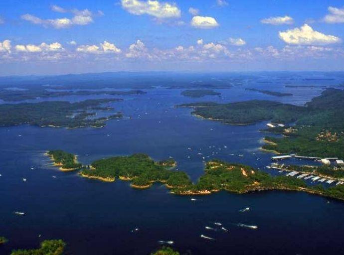
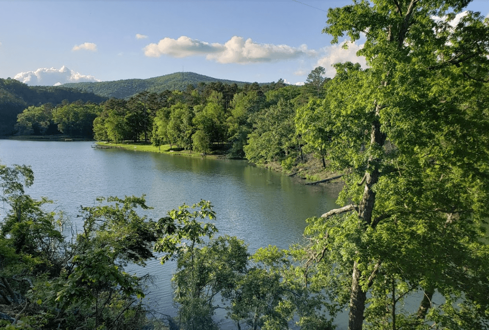
Area Lakes
Lakes offer a variety of recreational activities year round. So whether your desire is boating, fishing, camping, swimming, skiing, or personal watercraft…the perfect ingredients for a great vacation…we have a lake in our area that’s guaranteed to float your boat!
Find Your Mountaintop
Heart of the Ouachitas
Find your mountaintop in the beautiful Ouachita Mountains. Your mountain top may be a hike through the National Forest or fishing our crystal-clear streams. Others find their mountain top biking on our EPIC trails. Come find your mountain top. It is waiting for you. visitouachitas
Other Local Attractions